Friday, January 29, 2010

Following Verlen and Valerie XV - The Churchill River


Wikipedia: "The Churchill River is a major river in Saskattchewan and Manitoba...From the head in Churchill Lake it is 1,609 km long."

Before this mighty river reaches its natural outlet at Hudson Bay it suffers the indignity of being diverted into the Nelson River for hydroelectric projects.

Valerie in Newsletter Number 4: "The Churchill River was the biggest river I had ever been on with rapids. The Mackenzie River had plenty of fast water, but the Churchill Rapids are actual drops of many feet. The first Churchill rapid that we passed through was at Patuavak, flowing into Shagwenaw Lake. We heard the water rushing from about a half mile away."


"We slowly paddled towards the drop, watching the water carefully. It didn't look too alarming so we chose to paddle through. I went first and headed straight for the 'V' shape of water flowing down from the exposed rocks. I soon learned that in big water the 'V' is the place to stay away from, not to head for, as I was used to doing in shallow water. Luckily the rapid wasn't too bad and though I found myself with waves jumping onto the deck, it wasn't anything the stable Sea Wind couldn't handle. I learned right then and there to take more time scouting the river areas ahead and to watch Verlen more closely. He was navigating a cautious stretch of water closer to shore."

At Patuanak (the Newsletter spelled it Patuavak) Verlen held a discussion with a native riverman, whom he had met in 1981 on the Ultimate Canoe Challenge, about the rapids they would be facing downstream on the Churchill..."You must portage the Dipper Rapids, everyone portages the Dipper...We go down Crooked Rapids in our power boats but there is a portage on the right...Now Snake Rapids, that's one of the worst..."

Valerie's Newsletter reports contain some real worries she had about their facing Snake Rapids. At one point she was trying to figure how she could "... get Verlen's body back to civilization after a possible catastrophe."

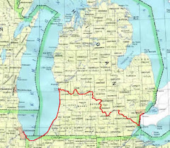
The book One Incredible Journey, the story of Verlen's and Clint Waddell's trip across Canada in one season in 1971, has a very good map of the route that the Krugers were traveling in reverse. It shows how the Churchill is really a series of lakes interconnected by straits or sections of river. In order going downstream they are Peter Pond Lake connected by the Buffalo Narrows to Churchill Lake, Lac-Ile-a-La Crosse where Putuanak is located, Shagwenaw Lake, Dipper Lake, Knee Lake, Sandy Lake, Pine House Lake, Sand Fly Lake, Black Bear Island Lake, Trout Lake, Lake of the Dead, Otter Lake, Red Lake, Trade Lake, Keg Lake and Iskwatam Lake.

Although their accounts contain practically no details of their trip down this chain of lakes and straits; their thanks in the Newsletter tell of hospitality and help they received from people in Buffalo Narrows, Patuavak, Primeau Lake, LaRonge, Stanley Mission, Mista-Nosayen, Amisk and Sturgeon Landing along the way to Lake Winnipeg.

At the end the Churchill turns to the east and continues towards Hudson Bay but the Voyageur Trail diverts south across the Frog Portage to the Sturgeon Weir River system, heading for Lake Winnipeg.

I have used my Google Maps virtual helicopter for hours trying to trace their route through this maze of lakes, straits and narrows that zig-zags across the Canadian Shield wilderness. This has proved to be quite difficult because the vast majority of the lakes and waterways are unnamed on the satellite coverage, and the map coverage is very sparse.

The purpose of the Krugers' entire trip through the chain of lakes from the Methye Portage to the Frog Portage is to take them across the Churchill River-to-Hudson Bay drainage basin and into  the Lake Winnipeg-to-Nelson River-to-Hudson Bay drainage basin.

Next: Lake Winnipeg and beyond

Monday, January 25, 2010

Following Verlen and Valerie-XIV-The Methye Portage


Here is something I pulled off the Internet which is very descriptive of what the Krugers would have seen when they got to their destination after struggling upstream on the Clearwater River (From "Great Canadian Rivers").
 
"At an overgrown landing in a small cove not far from the Saskatchewan-Alberta border, Clearwater River runners will encounter a path leading steeply up to a forested ridge. A short hike into the woodland above reveals an historic trail. Worn down by the feet of countless aboriginal hunters, voyageurs, pack horses and moose, and deeply rutted by the the wheels of fur-laden ox carts, the trail extends 20 kilometers over a pine and spruce-covered sandy ridge.
 
The legendary Methye Portage spans a plateau separating the Clearwater River from Lac la Loche and marks a continental divide between the Churchill and Athabaska-Mackenzie River systems. (the Churchill flows into Hudson Bay). In 1778 this short stretch of land became the one of the busiest hubs of the 19th Century fur trade, opening up the rich fur country of the North West to the merchants of Montreal."
 
Not the Kruger expedition, but a good reality check on what it takes to make a portage. (From the ottertooth.com Che Mun page.)

Valerie describes their crossing of the portage: "We arrived at the trail in the early afternoon and shouldered our packs to begin the long walk. We always take our packs first because when we carry the canoes on our heads and shoulders our visibility decreases. We take the first load to familiarze ourselves with the trail. The path gained 800 feet of elevation in the first four miles so there was plenty of huffing and puffing on our parts. But it was beautiful, walking through the woods on a trail that had so much colorful history. I tried tio imagine the voyageurs carrying their packs and stopping every 15 minutes for a "pose" which means rest period. They could set down their packs and smoke a pipe. To the voyageurs the portages weren't measured in miles but instead were described as being "three or four pipes".
 
Valerie goes on: "It was getting dark on August 10, 1986, as we arrived at Rendezvous Lake, a beautiful spot at the four-mile point of Methye Portage. There, with the sounds of loons and the magic spell of the Northern Lights, we made our camp." They had eight more miles to go.
 
Here is something I didn't know. They had been carrying a set of wheels. Valerie again:
 
"Ralph Freese at the Chicagoland Canoe Base had sent us a cart to use on those portages that were flat enough and wide enough to accomodate the wheels. For the first time, we tried them out, making a Sea Wind 'sandwich' of our canoes, stacked on top of each other, with me pulling and Verlen pushing and steering from the stern. We made those eight miles in one trip! And averaging one mile per hour!"
 
Verlen and his partners had crossed this portage in the other direction in 1971 and 1981. I read his accounts of both crossings. He complained a lot about mosquitos.
 
After the portage Verlen and Valerie were heading downstream for the first time since they started the Two Continent Expedition. Lac la Loche connects the portage with the Methye River to the south. The community of La Loche on the eastshore was undoubtedly visited by the Krugers on the way.
 
Valerie: "The Methye River has a seies of fast waters and it was quite a switch, feeling the canoe pulled along and floating pell mell down a whitewater shoot!  The rapids on the Methye were small compare to the Churchill River Rapids still ahead of us."
 
Next: The Churchill River.

Tuesday, January 19, 2010

Following Verlen and Valerie XIII - To Fort McMurray and the Clearwater River


In the Newsletters neither Verlen nor Valerie describe their journey upstream of Fort Smith. In effect, they skip over the rivers, towns and lakes they traveled all the way to Fort McMurray, Alberta, where Verlen decided he could paddle again.
 
To fill in the gap I turned to the accounts in One Incredible Journey and The Ultimate Canoe Challenge and worked backwards on the descriptions of the trips FROM Fort McMurray TO Fort Smith. Then I invoked the Googled virtual helicopter and Wikipedia to follow the Krugers' undescribed route.
 
Verlen has characterized the upper Slave River as the most uninteresting river he has ever paddled; no scenery, mud banks all the way and no good campsites. The name is Indian, having nothing to do with human slavery.
 
The Slave originates in the Peace-Athabasca Delta, a highly unusual fresh-water delta at the forks of the Peace River and Riviere Des Roches, the drain of Lake Athabaska, which in turn is fed by the Athabaska River. The delta is in the very southwest end of Lake Athabaska where the Peace River comes in from the west, having originated in a Rocky Mountain Glacier.
 
The Krugers would have navigated their motorized tandem Sea Wind rig through the maze of streams in the Delta (probably marked by buoys) and turned east up the winding Riviere Des Roches into Lake Athabaska, 176 miles long and 31 miles at its widest.
 
Fort Chipewyan, located at the western tip of Lake Athabaska, is one of the oldest settlements in Alberta, having been set up as a trading post in 1788. I am sure the Krugers would have stopped there for mail and re-provisioning and gasoline for their outboard.
 
They would not have explored Lake Athabaska because the Athabaska River enters the lake at it extreme southwest end in the delta, having flowed in from the south. They motored on upstream to Fort McMurray. I mounted my virtual helicopter and followed along.
 
The trend of the Athabaska is almost straight south to north with many islands but little wandering.
 
Fort McMurray is a town at the confluence of the Athabaska and Clearwater Rivers. It is the center of activity for the development of the Athabaska Oil Sands, an enormous reserve of heavy oil-saturated sand that is mined and retorted to make transportable and refinable crude oil.
 
The Clearwater flows in from the east. At Fort McMurray it is affectionately known as The Chant. I don't know why. Going upstream on the Clearwater will lead to the Methye Portage at the divide between waters flowing to the Arctic and the waters flowing to Hudson Bay.
 
When they arrive at Fort McMurray Verlen decides that he has healed enough to paddle again so they happily dismantle the tandem rig, sell the outboard motor, and head up the Clearwater in their liberated Sea Winds solo.
 
The Clearwater was the first really wild river the Krugers encountered on the Two Continent Expedition. The Mackenzie, Slave and Athabaska all had occasional towns, were used for barging and usually had roads parallel or crossing. The landscape around Fort McMurray is scarred by oil sands mining. The very falls and rapids that forced them into portaging kept that river wild.
 
Valerie: "The Clearwater was the prettiest river we had seen so far and the rapids and waterfalls we encountered were easy to identify. We paddled tight to shore and we could see white foaming water far in advance as we searched for the portage trail.
 
For those readers who don't know what a portage is, I have a simple definition: A portage is a carrying place where the paddler must leave the water and transport canoe and gear overland to bypass a dangerous rapid or to reach an alternate waterway...No definition can ever adequately explain what portaging means. I never understood until I had carried my own canoe on my back and food bag, sleeping pad, tent, clothes...extra shoes, water jugs, rain gear, spare paddle...and other stuff miles through the woods.
 
On our first few portages we were very disorganized. By the time I packed all the gear from my canoe into manageable bundles it was clear each of us had three trip-loads of stuff to carry over the distances ahead ahead of us. Counting forward and back, a one mile portage turned into a 5-mile trip!"
 
As I think back, I believe these would have been her first actual experiences with
portaging. There were no portages on the Baja trip and probably none on the race down the Mississippi.
 
I reviewed the accounts of Verlen's two previous trips on the Clearwater, both downstream from the Methye Portage, one in 1971 and the other in 1981. He had no trouble with either, apparently running all the rapids. Going upstream was different since they had to paddle or pole or line up or portage every one, and there are many. Unfortunately Verlen doesn't describe any and everything Valerie has written is summarized above.
 
To try to get a feel for this river I used the Google virtual helicopter approach but was frustrated by very poor satellite imagery on the upper part. I had better luck with Digital-Topo-Maps.com. This web site gave me very detailed black and white topography with contour lines, a medium I'm somewhat of an expert on going back to the Colorado School of Mines in the 40's and the US Army Engineers during World War II. I enjoyed myself. A "topologist's" holiday, so to speak.
 
Every rapids, falls and portage is shown in detail, the contour lines give you a sense of 3D that is missing from satellite or aerial photo coverage and most lakes and streams are named.
 
Next: The Methye Portage and the Churchill River

Sunday, January 17, 2010

I had a dream...


I was doing a lot of thinking about Grand River Expedition 2010 last evening in response to a message from our esteemed leader, The Riverologist. That mental activity was apparently stimulating since after I went to bed and fell asleep I had this rather complicated dream which I feel compelled to share with you and the canoeists named in the "Cc" box.
 
My Dream: About 50 or 60 canoes and kayaks of GRE 2010 were in their 13th day on the Grand River coming into Grand Haven, most heading out for a quick turn into the Big Lake and back. Among them were a number of Kruger Sea Wind expedition canoes with very experienced paddlers. They tended to hang around out beyond the breakwater looking "cool".
 
While out there they noticed two ghostly birchbark canoes heading south. It was Hugh Heward and his crew on their 1790 journey from Detroit to the Chicago Portage!
 
Then they saw three or four ghostly Sea Winds following Hugh's trail. It was the intrepid Challengers from the 2009 Ulitimate Hugh Heward Challenge!
 
"Do you see what I see?" shouted one GRE paddler. "Don't let them out of sight!" shouted a second. "Let's catch up to them!" added a third and with that they dug in their paddles and raced after the apparitions.
 

Well, they never could catch up no matter how hard they tried until they got opposite St. Joe, and there beneath the bluff was a ghostly fleet of 8 or 10 birchbark canoes, with about 30 ghostly Frenchmen and one ghostly Indian from the doomed ship Griffon, busily preparing to go up the St. Joseph River. It was the great explorer LaSalle's 1679 expedition!
 
Our heroes decided to stick with LaSalle while the ghostly Heward and the ghostly Ulitimate Challengers continued on down the Big Lake on their way to the Chicago. Portage.
 
When the Frenchmen started up the St. Joseph (which they called The River of the Miamis) our heroes followed along a discreet distance behind until they got to the portage where someday there would be the City of South Bend and a college that used to have  good football teams..
 
 LaSalle sent the Indian across the portage to check it out and he returned saying that it ended in a big marsh but he could see moving water so the Frenchmen hoisted their canoes to their shoulders and grabbed their packs and set off at a trot across the portage.
 
Our heroes always carried wheels in their Sea Winds but there were no roads, nothing but  a buffalo trail. Nevertheless, they did not want to get left behind so the mounted their canoes on their wheels and went bumping cross-country. One even used a bicycle, the first time ever where the State of Indiana would someday be (remember, it was a dream...all things are possible). 
 
Launching their Sea Winds in the marsh they followed the disturbed reeds left by the Frenchmen and were soon on the free-flowing Kankakee River. In due time the Kankakee was joined by the river the French called DesPlaines (which flowed down from the other side of the Chicago Portage) to form the Illinois River, so named for the Illinois tribe of Indians who lived along it.
 
They followed the ghostly LaSalle down the river but he stopped about where Peoria is today and decided to build another fort like the one he had built at the mouth of the St. Joseph. Well our heroes were nonplussed since they didn't want to hang around Peoria (who would?).
 
But just about that time here comes another apparition. Coming upstream in a ghostly canoe was a ghostly Jesuit priest and a ghostly French explorer. It was Father Marquette and Louis Joliet on their way back from their 1673 "discovery" of the Mississippi River (the natives already knew where it was).
 
So now our heroes had a dilemma, should they go on down the Illinois and see the "Father of Waters" or should they follow Marquette and Joliet back up to Lake Michigan and home?
 
This is where I woke up. It had been a remarkable dream, despite being interrupted by an old man's nightly pee calls. Does it give anyone any ideas as to another historical canoeing adventure????
 
As Verlen said "Happy are those that dream dreams..."
 

Friday, January 15, 2010

Following Verlen and Valerie-XII-To Slave Lake and Slave River

Continuing on the Mackenzie:

Wikipedia: Fort Simpson. is a village...located on an island at the confluence of the Mackenzie and Liard Rivers...(it) was first started as a trading site in 1803 then named Fort of the Forks post..."

Fortunately for the Krugers, it has a hospital.

Valerie: "When we arrived at Fort Simpson we caught a ride to the hospital where X-rays were taken of Verlen's back. The doctor said being on the river was a great risk, and that Verlen had suffered a 'massive muscle tear'. Verlen was still in great pain and had difficulty even walking. We knew he couldn't possibly paddle...

There were some difficult decisions to be made...we couldn't end the expedition...(after) much soul searching...we purchased a used six hp motor to assist us until Verlen could paddle again...Verlen supervised the building of a flat transom and platform that would fit between the canoes and hold the motor. We used that motor from Fort Simpson to Fort McMurray - approximately 1000 miles."

Then she describes the stresses and strains on the rig and their partnership as a result of having to travel with a noisy outboard motor. I have never seen a photograph of that rig.

Valerie continuing: "We traveled up the remainder of the Mackenzie to Great Slave Lake, crossed the south end of the lake and stopped at Hay River and Fort Resolution...it was a long 200 mile stretch up the Slave River to Fort Smith...Using the motor was a disappointment to us but it certainly didn't effect the warm, friendly greetings from people on shore...the Royal Canadian Mountie at Fort Providence even...drove us to the gas station to fill up our gas cans."

They traveled on to Fort Smith, just below the famous Slave River "Rapids of the Drowned", then Fort Chipewayan and the Athabasca River to Fort McMurray where Verlen pronounced himself ready to paddle.

I mounted my Google Earth virtual helicopter and followed along.

Great Slave Lake is the deepest lake in North America and 9th largest in the world.

Hay River is a town located on the south shore of Great Slave Lake at the mouth of the Hay River. The area has been used by Indians as far back as 7000 B.C.

Fort Resolution is located at the mouth of the Slave River on the south shore of Great Slave Lake. It is the oldest documented community in the Northwest Territories.

Fort Smith is a town on the Slave River adjacent to the Alberta/Northwest Territories border. The Indian name was Thebacha, "beside the rapids". It is at the end of an ancient portage around what were considered to be four impassible rapids.

Both Verlen and Valerie tell of arriving at Fort Smith just below the famous Slave River "Rapids of the Drowned" but neither tell how they got their cobbled together, hybrid catamaraned Sea Winds-with-outboard-motor above these rapids and the three big rapids above them.


This is an example of why it is so regrettable that neither Verlen nor Valerie nor anyone else did a book on the Two Continent Canoe Expedition.

In their 1987 book One Incredible Journey Verlen and Clayton Klein go into 17 pages of detail about Verlen's and Clint Wadell's 1971 adventures paddling in and portaging around these Slave River rapids.

Here are extracts about these rapids from Verlen and Brad Frentz's 2005 book The Ultimate Canoe Challenge when Verlen and Mark McCorckle went through in 1981 (partner and son-in-law Steve Landick had gone on ahead by himself): "There are four main rapids, Cassette, Pelican, Mountain and Rapids of the Drowned, each about a mile long. As the name of the last one suggests, these are dangerous waters and through the centuries many lives have been lost in them...I had a copy of Alexander Mackenzie's journal...It pleased me to follow his detailed descriptions; they were still accurate and useful. Mackenzie and his party went through this wild stretch of river in 1798 and needed nine portages. Mark and I used the same nine portages and they were still good."

Verlen and Mark also ran some of the rapids

"I had come through these rapids before, and we studied them carefully before the trip. So I knew what to expect. But we still landed above each rapids and looked things over".

We used the same procedure during my 1948 wilderness canoe trip in Western Ontario. The Canadian Government maps we navigated with always showed where the rapids were and you could always tell by the sound when you were approaching them. The four of us would get out of our canoes and walk the banks and plot out a route as best we could. Each canoe crew misjudged once. My brother and I wiped out when we didn't hit a big "V" dead center and had to ride the rest of the rapids "bareback" (you swim on your back with your feet downstream ahead of you...no PFDs in those days).

Verlen describes shooting the Cassette Rapids in detail. He goes on: "The remaining three rapids were runnable using Mackenzie's descriptions, and we came into Fort Smith in good shape".

Next: To Fort McMurray.

Tuesday, January 12, 2010

Following Verlen and Valerie-XI-More of the Mackenzie

Newsletter Number 2 dated August 1986 has the Krugers over 600 miles upstream, a month after they started. They were downstream some place from Wrigley.

Verlen: "The river is at its seasonal high and there's an enormous amount of logs and debris rushing by. Some of the logs are huge, having come from hundreds of miles upstream, from above the permafrost. Some are freshly fallen trees, washed into the river by eroding banks. It will be years before some of them make it to the Arctic Ocean...We paddled hard this morning against a strong headwind and stiff current, but when the debris and logs became hazardous in the rising water, we decided this would be a good time to head for shore and write our Newsletter dispatches"

Valerie: "As far as we can tell, we are the only ones since Alexander Mackenzie in 1789 who have paddled upstream on this great river...Our progress does not come easily...The river is coursing by so fast that nothing stands in the way...If we stop paddling even for an instant, the river carries us backwards...We learned quickly that river is in charge - and we work with it as best we can."

That they were approaching Wrigley meant they had passed the communities of Norman Wells and Tulita. They undoubtedly stopped and visited or shopped.

Wikipedia: "Norman Wells (Slavey language: Taeghoti 'where there is oil') is the regional center for the Shatu region of the Northwest Territories...Oil was first seen by Alexander Mackenzie during his exploration of the river in 1789 but it was not until 1911 that an oil bearing formation was discovered. Imperial Oil was established in the area in 1937...During the Second World War, Norman Wells was deemed important as a source of oil for military operations in Alaska..."

Spectacular Northwest Territories.Com: "Tulita - "Where Two Rivers Meet" - is a small...community at the confluence of the Great Bear and Mackenzie Rivers. It began as a trading post in 1810. Old Hudson Bay Post buildings still overlook the river...." Tulita was originally known as Ft. Norman.

Wikipedia: "Wrigley...The community is located on the east bank of the Mackenzie River...below its confluence with the Wrigley River...Originally located at Fort Wrigley, the community relocated to its present location in 1965, because it was more easily accessible. The population continues to maintain a traditional lifestyle, trapping, hunting and fishing."

Valerie: "As we pushed off from Wrigley we faced 140 miles before reaching the next town of Fort Simpson...The increased current was causing us a lot of extra work and made paddling more difficult. It was during this stretch that Verlen suffered an injury. We were paddling over a gravel bar at the mouth of a river flowing into the Mackenzie, but because the current was so swift, we were having trouble with our paddles on the gravel as the bar made the water too shallow. So we used poles to propel ourselves forward, and as Verlen pushed off one time with a strong effort he slipped and fell heavily into the rigid canoe cockpit."

Verlen was obviously injured but appeared to ignore it and with him popping aspirin for the pain they kept going, paddling 13-15 hours a day. Then on July 14 they were pushing through a rapid when Verlen abruptly stopped paddling.

Valerie: "...his canoe began to slide backwards...his canoe came crashing into mine. I jumped ashore and grabbed his bow rope, pulling him to safety. From he pain on Verlen's face, I knew something was dangerously wrong!"

Velen had felt something snap in his back and couldn't move.

Valerie: "I began to cry. The enormity of the situation was overwhelming." Then she got her act together.

Her brother's account: " Struggling to shore, Valerie said they were in sight of a cabin on the opposite bank...they camped the night and the next day Valerie more or less single- handedly ferried the boats and Verlen cross the river. The cabin man 'Leo' then drove them 32 miles to Ft. Simpson".

Valerie's account in the Newsletter is much longer and is vivid. Leo actually took them to Fort Simpson in his fishing boat; the two Sea Winds and all their gear on board, with his wife, son, dog and a load of fish along.

Using Google Maps I believe I have zoomed in on the exact location where this all took place.

Next: Verlen in the hospital

Thursday, January 7, 2010

Following Verlen and Valerie-X-The Mackenzie River

OK. I'm going to take a crack at following Verlen and Valerie across Canada on their Two Continent Canoe Expedition.  My main source will be the Newsletter collection loaned to me by Jon Young.

The newly married Krugers started paddling their Verlen-built Sea Wind canoes up the Mackenzie River in June of 1986 at Inuvik, a modern Canadian government-built town located close that river's East Channel. They were about 60 km upstream from the Arctic Ocean.

I could see right away when I started this project that the distances involved were far too great for my leisurely Google Maps "seagull" approach that I used in followng the Krugers from Michigan to the Gulf. So I shifted to the "virtual helicopter" approach that I used for following Charlie Parmelee's 2008 Odyssey and the Ultimate Hugh Heward challengers last spring.. This involves going to Google Earth, finding the waterway, tilting the perspective and rotating the image so as to follow the paddlers' path upstream, downstream or cross country as appropriate.

As was the case with my last project, I am not attempting to tell the untold story of the Krugers' Two Continent Expedition. Rather I am trying to share with you my effort to follow their path. As usual, if you want to opt out, just say so.

Valerie: "On June 6th at 4:17 AM the ice went out of the East Branch of the Mackenzie River, jamming, jostling and grinding past the arctic town of Inuvik. Verlen and I couldn't sleep. We sat on a knoll above the river, watching excitedly as the ice scraped against the shore, splitting and sliding on top of itsself...Verlen and I were mesmerized...The 24 hour arctic sun moved along the horizon and lit the scene bright as day...For all the scraping and whining, the ice glided by beautifully, in a slow motion dance of spring..."

Valerie again: "Verlen and I are setting out to explore the Western hemisphere by solo canoes and we feel as if we are two of the luckiest people alive...I continue to have the most wonderful feelings that I am exactly where I am supposed to be...on the Mackenzie riverbank in time to watch the ice break and move, clearing a channel for us to Cape Horn."

Wikipedia: "The Mackenzie River originates in Great Slave Lake in the Northwest Territories, and flows north to the Arctic Ocean. It is the longest river in Canada (1,080 miles) ..."

Newsletter Editor Dorothy Webster: "The latest news from Valerie and Verlen found them at Fort Good Hope 214 miles from Inuvik, their starting point. 'It was our longest stretch of wilderness paddling', said Val. They were averaging 22 miles per day...they're often paddling until midnight or later."

I have put my Google Earth virtual helicopter in motion and have followed them up the Mackenzie to Fort Good Hope. Though not mentioned in the Newsletter about half way between Inuvik and Good Hope they would have arrived at Tsiigehtchic, a community at the confluence of the Arctic Red River and the Mackenzie. Here the Dempster Highway crosses the Mackenzie (ferry in summer, ice road in winter). The Dempster interconnects the Klondike River with the Arctic Ocean shore at Tukteyaktuk. You might want to look it up.


I am surprised that neither Velen nor Valerie commented on the rapids and Ramparts near Good Hope. The Ramparts are a spectacular-looking limestone gorge maybe 10 miles long upstream from Good Hope. The rapids may have been drowned by the high water they were struggling with. Good Hope was the oldest trading post in the lower Mackenzie valley.

Next: To Norman Wells and beyond.


Monday, January 4, 2010

Following Verlen and Valerie-IX-Down the Tombigbee to Mobile


After the Holidays I have resumed following Verlen and Valerie on their Two Continent Canoe Expedition.
 
Coming down the Divide Cut the Krugers would have first encountered the backwater of the Bay Springs Dam. After locking through they shortly would have passed under a bridge carrying the Natchez Trace Parkway across the Waterway.
 
Wikipedia: "The Natchez Trace, a 440 mile long path extending from Natchez, Mississippi, to Nashville, Tennessee, linked the Mississippi, Tennessee and Cumberland Rivers. It was a traditional Native American trail and was later used by European explorers as both a trade and transit route in the late 1700s and early 1800s. Today the trail has been commemorated by the 444-mile Natchez Trace Parkway, which follows the approximate path of the trace. The trace itself has a long and rich history, filled with brave explorers, dastardly outlaws and daring settlers. Parts of the original trail are still accessible."
 
Thirty years ago Elaine and I drove the length of the Parkway in our 1978 Chrysler LeBaron, 8-track playing.
 
I still have an 8-track setup here at the River House. In memory of Elaine I have been playing some of those tapes including "The Theme from Rocky", some Bert Bacharach and even some Glen Miller pieces from our youth. I also played the banjo music from that 1976 canoeing classic "Deliverance". If any of you youngsters haven't seen "Deliverance"' you should definitely rent it.
 
Next downstream for the Krugers was Montgomery Lock, John Rankin (D) Lock, Fulton (C) Lock and Grover Wilkens (B) Lock, each with a lake behind. The latter is near Smithville, Mississippi. Then the lock for Pool A near Amory, Mississippi; Aberdeen Lock and Dam, and John C. Stennis (Columbus) Lock and Dam backing up Columbus Lake. (There is a also a US Navy Aircraft Carrier named for Senator John C. Stennis).
 
Then into Alabama on the channelized Tombigbee to the Tom Bevill (Aliceville) Lock and Dam and the Howell Heflin (Gainsville) Lock and Dam then to Demopolis and the confluence with the Black Warrior River. The Demopolis Lock and Dam is located a short ways downstream of the town. (The lock names in parenthesis are how they were designated when Verlen and Valerie went through).
 
Dermopolis is the end of the Tennessee-Tombigbee. From there on it is the Black Warrior-Tombigbee Waterway.
 
A little more than half way between Demopolis and Mobile is the Coffeeville Lock and Dam.
 
Farther down the Tombigbee joins the Alabama River and when the river-brown water changes to salt-water green in Mobile Bay I am done following Verlen and Valerie. I am a fresh water-cool weather canoeist.
 
Maybe you Florida types might want to take them from here on. If I get ambitious I might head north and enlist a seagull over the mighty Mackenzie and follow Verlen and Valerie upstream and across Canada.
 
From Phil Peterson's All Things Are Possible: "Verlen  and Valerie continued south throughout the winter. By March13, 1987, they were in Mobile, Alabama, 7,000 miles south of their starting point at the mouth of the Mackenzie River...Their spirits remained high...They had come through the seven locks of the Tombigbee Waterway, and had been introduced to parts of the country and its people that neither had seen or met before."
 
Same for me and my virtual seagull.

Friday, January 1, 2010

Bill Davis on the Grand River


Bill Davis is a lawyer with an office in Grand Ledge and a home in the "Little Egypt" area among the bends of the Grand River upstream of Portland. In preparation for Grand River Expedition '90 Verlen Kruger and I met him at his home to discuss our travel through "his" portion of the river. I say "his" because I think of Bill as the Grand Poo-Bah of what I consider to be the best stretch of the Grand, that from Charlotte Road Bridge to the mouth of the Looking Glass River.

He is one of the ramrods of the Middle Grand River Water Trail Association. Visit their booth at the Quiet Water Symposium March 6.

Bill is a self-professed "slow paddler" who likes to drift down his section of the river, sometimes even backwards, to soak in all the beauty and sneak up on the wildlife. In fact; at the Hugh Heward Challenge hoopla a couple of years ago, as spokesman for the Verlen Kruger Memorial Association when they presented me with that bronze statuette of Verlen, he was carrying like a scepter a paddle with large holes drilled in the blade which he calls his "Slow Paddle". He is at the absolute opposite end of the paddlers' spectrum from the racing Bradfords who look neither right nor left as they are breaking speed records down the river.


In 2005 Bill wrote a paeon to his river entitled "The Awesome Grand River." It is such a beautiful piece that I feel I have to share it with you as sort of a New Year's gift.


(message from Jim, posted by Karen)