Tuesday, December 29, 2009

How Project Lakewell Changed My Life


Back in 1986 when I retired from the State of Michigan my fellow workers gave me an electronic fish finder as my retirement gift, believing that bass fishing was going to be my retirement hobby. My wife gave me a look which said: "You don't really believe you are going to spend a lot of your retirement time away bass fishing, do you?"
 
No, come to think about it, I guess I really didn't. But I did start to convert my Jon Boat into a poor-man's bass boat and spent a lot of time looking the Bass Pro Shops catalog.
 
I had fended off the oil and gas companies, utilities and law firms who wanted to hire me full or part time or use me as a consultant or lobbyist. I was determined to really retire, period.
 
As I mentally inventoried my interests I came up with canoes (I am a long time member of the Wooden Canoe Heritage Association); history, particularly Michigan history; genealogy and maps. I have a  large collection of Michigan topographic maps as a result of being on the State Mapping Advisory Board and I was a topographic engineer in the Army during World War II.
 
Enough background and bio: A while after retiring, I'm not sure what year, Elaine and I were down at the riverfront in Lansing during "Riverfest" and there was this campsite set up with a group of people in voyageur costumes. In addition, in the river was this 26 foot fake birchbark Montreal Canoe made of fiberglass but looking quite authentic. It turns out that this was some organization called Project Lakewell (I'm still not sure why it is called that) that was a fur-trading days reenactment group.
 
I was immediately fascinated and since their dues were cheap ($15) I signed up to become a member of Project Lakewell on the spot.
 
The guy who signed me up was this skinny-legged guy in a skimpy voyageur outfit called "Pierre" who apparently steered the canoe. I later learned he was Jim Meyerle. There was another guy, middle aged I would guess, with a big, gray handlebar mustache, dressed in black. He was supposed to be Father Marquette. It was Ken Kuester who promptly gave me a "Bless you my son" greeting. There were some female role-players, also in costume, one of whom I believe was that well-known author of children's books, Janie Lynn Panagopoulis. Enough name dropping.....I could add many more Lakewell people whom I got to know and respect like Dave and Jack and Frenchie.
 
That winter I got an invitation to come to a meeting of Project Lakewell at Ken's house, the subject participation in something to be called Grand River Expedition '90. There I learned the group intended to paddle their big canoe the length of the Grand River under the leadership of the world-famous long-distance canoeist Verlen Kruger and his then-wife, Valerie Fons Kruger.
 
If it hadn't been for that meeting I would probably only have watched Grand River Expedition '90 from the river bank as the canoes floated down and would never have become involved with the Krugers, who ended up as dear friends and neighbors.
 
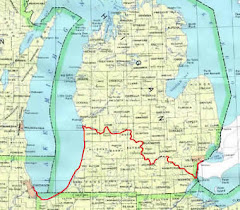
At that meeting it became clear to me that because of my work with Michigan maps that I might knew more about the Grand River than anyone present. It later became obvious (to me at least) that I was better informed about the Grand than probably anyone else involved with the expedition, particularly with respect to the headwaters.
 
When the regular monthly planning meetings for GRE '90 got started I met Verlen and Valerie and shortly started accumulating assignments. Verlen was the designated Rivermaster and Valerie became the expedition's chairperson and ramrod.
 
I first volunteered to take the lead on headwaters activities. I drove Jim , Ken and I forget who else to Jackson and Hillsdale Counties and showed them the streams and dams and ponds from which the Grand flowed.
 
On that trip I met Art Hunter (?) and his wife, proprietors of the Liberty Mills General Store, who became interested and involved with GRE '90 and led the charge and greased the skids for all that was done at or about the headwaters. They owned the dam (the first on the river) which became to focus of headwaters activities both for GRE '90 and GRE 2000 ten years later. I was the MC for the opening day ceremony in July of 1990 (a whole other story) and in 2000.
 
I also became responsible for the two historical markers sponsored by GRE '90, one an official State of Michigan Historical Marker on the Riverwalk in Lansing, and the other an engraved glacial boulder at the Liberty Mills dam. That boulder came from Bunday Hill, the highest elevation in the Grand River watershed. The words on both markers are mine.
 
I also helped the Krugers by scouting out campsites for the 13 days the expedition would take going down the river. My late canoeing buddy George Voorhis paddled with me for three days on GRE '90.
 
Another life changer resulting from my Project Lakewell membership is the annual Hugh Heward Challenge and the 2009 Ultimate Hugh Heward Challenge. More on that later.
 
In 1990 I read an article in the Lansing State Journal by history writer Birt Darling about a 1790 trip in two birchbark canoes by the British trader Hugh Heward and seven French-Canadian paddlers from Detroit to the Chicago River. They crossed the Lower Peninsula by going up the Huron River and, after portaging across the Lake Erie-Lake Michigan divide, paddled all the way down the Grand River to Lake Michigan. Thus they went down the Grand exactly 200 years before GRE '90 was to go down the same river. I was thereby inspired to determine exactly how the Heward party got from the Huron to the Grand.
 
"Topology" is defied as the topographic study of a place in relation to its history. I consider myself to be a topologist and that topology is my retirement hobby. In the winter and spring of 1990 I studied my topographic maps and made many trips by car reconnoitering Heward's possible routes until I became convinced I knew exactly how and where the Heward party paddled and portaged between the Huron and the Grand.
 
I shared this information with Verlen and he decided to prove me right or wrong his way, by launching his canoe in the Huron and paddling and bushwhacking to see if he could get to the Grand the way I believed Heward did. It took him two days, but he did it and it was my way. Since, many adventurous paddlers have followed Verlen's path, usually stopping in Hell for beer and pizza.
 
According to his journal, on April 28,1790 Heward's party, having encountered "an ill looking band" of renegade Indians the day before, paddled nearly 50 miles down the Grand River in one day before they felt safe to camp. In the aftermath of GRE '90 I issued a challenge by letter to a number of mid-Michigan canoeists, including Verlen, to try to try to match the Heward expedition's sprint by birchbark canoe with their sleek, modern canoes.
 
To make a long story short, my smart-alec challenge has become the Annual Hugh Heward Challenge, a 55 miler from Dimondale to Portland, a money raising function of the Verlen Kruger Memorial Association complete with T-shirts and feeding and speechifying at Thompson Field at Portland where Verlen's life-size bronze statue is to be erected. The first year 5 canoeists completed the challenge. Last year, the 10th I believe, 110 canoeists participated.
 
I have become sort of famous among a select group of canoeists for this affair and the related Charlie Parmelee 2008 Odyssey and the 2009 Ultimate Hugh Heward Detroit-to-Chicago Challenge and it all started with laying $15 on the table to join Project Lakewell that day at Lansing's Riverfest.
 
I have been honored by being presented with the Eaton County Heritage Award for 2001, the Verlen Kruger Award at the Quiet Water Symposium in 2004, and a bronze statuette of Verlen in 2007 for my initiation of the Hugh Heward Challenge.
 
Further, there is a series of self-published narrative/monographs that I have authored whereby I used the topology techniques I perfected in working out Hugh's route.  I have done "The Search for the Route of LaSalle's 1680 Walk Across Michigan", "Locating Michigan's Old Canoe Portages" (2 volumes) and "Across Lower Michigan by Canoe-1790". Other monographs that deserve Project Lakewell inspiration credit are "LaSalle's Elmbark Canoe", "Michigan's Whitewood Dugout Canoes" and "Hiawatha's Canoe". All are in significant Michigan historical libraries and museums.
 
One last thing that I can trace back to that day at Riverfest, my home "The Riverhouse" on the Grand River in Delta Township of Eaton County west of Lansing. I think it's the best place on the river. An acre of woods and meadow about 400 yards upstream of the Kruger Canoe Base with all of the land across the river an Audubon Wildlife Sanctuary. My wife found it while I was giving her a tour of places I visited during GRE '90. When the leaves are off I can see across the river the top of a big cedar tree in Hillside Cemetery, next to which Verlen is buried.

Saturday, December 26, 2009

Season's Greetings


Season's Greetings. In this video I was endorsing Karen's white-lights-only Christmas tree decorations by reciting a poem from my second grade Christmas program. Notice I had to call on the Savior to restore my memory.  (By the way - it was the "Plymouth" Congregational Church in Watervliet.) The hat is from the Dirty Duck, a country bar hang-out near Karen and Ken's cottage at Black Lake.


There shall be no glittering ware upon my Christmas tree
But only candles bright and fair
Each for a friendship rich and rare
That lights my life for me
And at the top
The very top
And closest to the star
Is the one I love the best
And dearest, there you are.

Friday, December 25, 2009

Dirty Duck Hat

Christmas gift from my son-in-law - a hand crocheted cap emblazoned with "Dirty Duck," the name of a local watering hole near my daughter and son-in-law's cottage on Black Lake.

Monday, December 21, 2009

Following Verlen and Valerie-VIII-The Tennessee-Tombigbee Waterway


My seagull is going to fly up the Tennessee River from its mouth at Paducah to see what this new Tennessee-Tombigbee Waterway is all about. But first there is Kentucky Dam which backs up Kentucky Lake....Kentucky Dam and Lake on the Tennessee River???? Go figure.....the lock is along the right bank.

Kentucky Lake.com: "Kentucky Dam creates the largest manmade lake in the eastern United States. It backs up the Tennessee River for 184 miles and creates a lake that stretches south across the western tip of Kentucky and nearly the entire width of Tennessee...it covers 160,300 acres." ....It nearly wore my poor seagull out flying a lake that long.

The lake eventually narrows to river size and going up the river the Krugers would have encountered the Pickwick Dam. Just before that on the left bank is the site of the Battle of Shiloh, one of the bloodiest battles of the Civil War. I have been there and it is very sobering to contemplate what went on there. I don't know what the Krugers thought as they passed by or did they visit it? You might want to look it up.

The Pickwick Dam or Pickwick Landing Dam has a lock along the left bank and backs up the Tennessee into a reservoir called Pickwick Lake.

The Divide Cut is a 29 mile artificial canal between Pickwick Lake and Bay Springs Lake which, as the name would indicate, crosses the divide between the Mississippi River drainage basin and drainage to the Gulf of Mexico through Mobile Bay. This is the beginning of the Tennessee-Tombigbee Waterway.

Valerie's words from the Newsletter of March 1987: "We have just completed paddling on the Tennessee-Tombigbee Waterway, a man-made 234 mile long, 9-foot-deep, 300-foot-wide transportation artery through west-central Alabama and northeastern Mississippi, connecting the Tennessee River with the Black Warrior-Tombigbee River Waterway.

On the Tenn-Tom...instead of portaging rapids and falls, we paddled our canoes into 11 locks that allowed us to be safely 'dropped' a total of 341 feet. Each lock is110 feet wide and 600 feet long, capable of accommodating a towboat and eight standard barges. When our 17-foot canoes entered the lock chamber we were treated with as much respect as 'the big guys' and certainly with much more interest...We first heard about the Tennessee-Tombigbee and the route it provides to the Gulf through a National Geographic article in 1986...The waterway is divided into three sections, the divide section, the canal section and the river, which provides a variety of scenery and a unique highway into the South.

We paddled past cotton fields and cypress groves, and areas where fishermen were dangling their lines and setting their nets for catfish. We also enjoyed the Tenn-Tom because it offered us a good downstream current..."

Verlen in the same newsletter: "...the Tenn-Tom (is) shorter and a better way South. It is more scenic and the water is cleaner than most other waterways. The people running the Tenn-Tom seem proud of it and intent on making it the showplace of barge canal systems. It will be interesting to see what happens in the next ten years".

Wikipedia: "During and after its construction, the $2 billion waterway was widely criticized as an example of excessive pork barrel spending."

I am flying down the waterway 22 1/2 years after the Krugers paddled down and it looks pretty neat yet. I would probably have to agree that it was a big pork barrel project. But not all pork is bad.

Next: Down the Tombigbee to Mobile and the Gulf

Friday, December 18, 2009

Following Verlen and Valerie-VII-The Ohio

The Ohio River follows the southern limit of the last of the continental glaciers.

Where the Wabash flows into the Ohio River water color contrast on the satellite photos shows the Wabash almost green and the Ohio definitely brown.

The Krugers would have gone downstream on the Ohio, probably close to the right bank, first past historic Old Shawneetown, then Cave-in-Rock.

Wikipedia: "After the Revolution, Old Shawneetown served as an important United States government administrative center for the Northwest Territory. Shawneetown and Washington, D.C share the distinction of being the only towns chartered by the United States government. In early November 1803 Lewis and Clark stopped at Old Shawneetown...." I'm taking the position that the Krugers were the next important explorers to stop there.

Cave-in-rock as a striking 55-foot riverside cave in a cliff by the Ohio which was a stronghold for outlaws.. Although they didn't mention it, I am sure the Krugers would have observed it and knew the story of the "Ancient Colony of Horse-Thieves, Counterfitters and Robbers". You might enjoy reading about it.

 Other Illinois towns passed would have been Elizabethtown and the old town of Golconda.

Just upstream of Smithland, Kentucky, where the Cumberland River enters the mighty Ohio from the south, they would have gone through the lock at the Smithland Dam which spans the Ohio. The lock is is adjacent to the Ohio's right bank. This is the first of many large and impressive dams that they would encounter on their way to the Gulf.

The Krugers have faced only two portages since they left Grand Portage on Lake Superior, the carries between the Au Train and Whitefish Rivers to cross the Upper Peninsula, and the Maumee-Wabash portage. Contrast that with Coach Larry Hoff going down the Wisconsin River earlier this year, he had to carry or use his wheels 26 times.

Verlen: "For this time of year, there was a lot of barge traffic on the Ohio River. At Paducah, Kentucky, we had to decide whether to go up the Cumberland or the Tennessee, the backwaters of both are joined together above their dam, about 30 miles upstream, forming two very large lakes. After much questioning we took the Tennessee - which was a good decision. There was very little current along the way."

The confluence of the Ohio and the Tennessee is close to downtown Paducah.


Next: The Tennessee-Tombigbee Waterway

Thursday, December 17, 2009

Following Verlen and Valerie-VI-The Wabash continued


I have received an Email from Valerie. She is reading these in her hospital room. I am so pleased and moved..

Further down the Wabash after Lafayette/West Lafayette you pass the towns of Independence, Attica, Covington, Perryville, Montezuma and Clinton. The terrain to the west gets hilly but the Krugers wouldn't notice much down at river level. Neither would they see much of the occasional big gravel operations.

Between Perryville and Montezuma the Vermilion and Little Vermilion Rivers come in from the west and Sugar and Big Raccoon Creeks come in from the east. Confluences of tributaries are always obvious at river level.

 A bigger and more historic town is Terre Haute, French for High Land for the prominent plateau the city sits on. Terre Haute is the home of Indiana State University where Larry Bird played basketball, and a Federal Prison that sometimes does executions. In the steamboating days Terre Haute was nicknamed "Sin City", famous for its Redlight District along the riverfront. For a less smartass description, see Wikipedia.

About  20 or so miles below Terre Haute the Wabash becomes the state line between Indiana and Illinois. I don't see any "Welcome" signs that one usually sees at state lines. In places where an oxbow has been cut off by man or nature the state line invariably follows the old oxbow.

Next is the little town of Darwin on the Illinois side. Here is the last ferry operating on the Wabash River. It is mostly used by Illinois farmers to get the their Indiana fields.

Just above Vincennes the riverside property lines change from the American survey quadrangular system to the old French ribbon farm system whereby the farms are laid out perpendicular to the river.

Vincennes....you wouldn't believe how much history this old town has, ancient Indian, Indian, French, British, American....you should look it up.

My late wife Elaine and I visited here in 1979 (how do I know the year? We were driving our 1978 Chrysler LeBaron, the fanciest car we ever owned, all leather seats with an 8-track sound system playing the "Theme from Rocky"). We were impressed by the George Rogers Clark Memorial which looks like something from the Mall in Washington, D.C. parked on the banks of the Wabash.

George Rogers Clark. Now there is a real American hero, who among many other valiant and incredible things, led American troops on a winter-time expedition by canoe and wading in swamps in a surprise attack on the British at Vincennes during the Revolutionary War. You really should look him up.

On another punitive expedition, Major Jean Francois Hamtramack (yeah, the guy for which the Detroit enclave is named) led his American troops and some local French militia up the Wabash against a Kickapoo Indian force supposedly camped at the Vermilion and Eel Rivers. They couldn't find any so they returned. "Hamtramack against the Kickapoo", I couldn't resist. I'm sure they didn't think it was so funny. You don't have to look that one up......

The Embarras River flows in from Illinois between Vincennes and St. Francisville. The name comes from French explorers who used the term for river obstacles like logjams.

Continuing downriver past St. Francisville the Krugers would have arrived at Mt.Carmel where the White and Patoka Rivers come in from the east. In the spring of 2008 Mt. Carmel was at the epicenter of a 5.2 magnitude earthquake that was felt all the way to St. Louis.

Next downriver is New Harmony, the site of two historic utopian communities. You might want to look them up.

The Little Wabash from Illinois joins the Big Wabash just a few miles above its confluence with the Ohio River.

Verlen: "Winter seemed to make one more effort to delay us the last few days of January on the lower Wabash River. The temperature dropped to near zero, the river became 90 per cent covered with broken ice, making travel impossible for a day, and rather difficult for several more days.

On our last night on the Wabash, we camped among trees on a muddy lowland bank. It was a cold, still night and all night long we could faintly hear the low throb of diesel engines - the sounds of barges pushing up and down the Ohio River, about 15 miles away."

Next: The Ohio.

Tuesday, December 15, 2009

Following Verlen and Valerie-V-The Wabash


My "Seagull" flew down the length of Little River. The upper part doesn't look like it would float a canoe but lower down there appears to be plenty of water. When it reaches Huntington there are two small dams. A couple miles west of town the Little, which appears relatively clear, flows into the colored Wabash. This confluence is a few miles downstream of a dam that holds back Huntington Lake.      

.Wikipedia: "The Wabash River is a 475-mile long river...that flows southwest from northwest Ohio...across northern Indiana to Illinois where it forms the southern Illinois-Indiana border before draining into the Ohio River, of which it is the largest northern tributary. From the dam near Huntington to its southern terminus at the Ohio River, the Wabash flows freely for 411 miles which makes it the longest stretch of free-flowing river east of the Mississippi...

When the Wisconsin Glacier melted 14,000 years ago, part of the meltwaters formed the pro-glacial Lake Maumee, the ancestor to Lake Erie. Eventually the meltwater overtopped a glacial moraine located near Fort Wayne, Indiana, and catastrophically drained southwestward in the Maumee Torrent. The torrent carved the wide alluvial valley that the Wabash flows through today."

Verlen's words: "The morning after Christmas (1986) we put our canoes into the Wabash River near Huntington...sixteen other canoes joined us for a few hours...The canoeists were not the usual fair weather paddlers...On the upper Wabash, there are a number of small rapids and fast water spots that pushed into "sweepers" (fallen trees). We hadn't gone a mile before an aluminum canoe misjudged and got swept into a sweeper, flipped and got trapped in partially submerged branches. It took us nearly a half hour with ropes and many helping hands to get the canoe free. The paddlers only got wet. Sweepers in fast water, especially on bends of the river are probably the worst and trickiest hazards on a small river. It is easy to misjudge the force of the water pushing your canoe where you don't want it to go. I have learned the hard way to treat sweepers with respect - to give them a wide berth and to keep my seat low."

"Seagulling" down the river near Largo, about the second town after Huntington, you find a most unusual geological phenomenon, "Hanging Rock" National Monument, a huge limestone cliff towering about 90' above the river's left bank and leaning over the river. Nothing around it but flat Indiana farm land. I can't imagine how or why the glacier didn't grind it down.

Continuing down the river you reach Wabash, Peru and then Logansport with the Eel River coming in from the right. All along roads, usually US 24, follow along the right bank where the Wabash and Erie Canal used to be.

A few miles upstream of Lafayette and West Lafayette the Tippecanoe River comes in from the north. This was the site of the Battle of Tippecanoe

Wikipedia: "The battle of Tippecanoe was fought on November 7, 1811, between United States forces led by Governor William Henry Harrison of the Indiana Territory and the forces of Tecumseh's growing American Indian confederation led by his brother, Tenskwatawa...The battle took place outside Prophetstown, at the confluence of the Tippecanoe and Wabash Rivers...Although the Americans were victorious...the win was costly as the tribes attacked with fewer men and sustained fewer casualties...Tippecanoe dealt a devastating blow to Tecumseh's confederacy, which never regained its former strength." You should read the rest of the Wikipedia article.

Neither Verlen nor Valerie mentioned the place or the battle, but I can't imagine that they didn't look over the battlefield which is located right by the river.

Next downstream is Lafayette and west Lafayette, the home of Purdue University.
I took a circle over Purdue's football field, Ross-Aide Stadium, I felt like I was in the Goodyear blimp on a fall big-game saturday afternoon.

Valerie: "I am discovering that miracles do happen. When we left Lafayette, traveleing downstream on the Wabash, I saw a movement on shore...and saw a bird thrashing in the mud. Verlen and I both paddled over - it was a hawk caught in a muskrat trap! Verlen carefully got out of his boat and poked the terrified bird with his paddle. The bird didn't peck or bite at the blade so Verlen felt safe enough to kneel down and work the trap until the bird was free. With no hesitation the bird flew into the air. I thought a long time about the fate of that bird..."

Next: More on the Wabash

Saturday, December 12, 2009

Following Verlen and Valerie-IV-The Wabash-Maumee Portage


I'm trying to put myself into Verlen's head when he was planning the Two Continent Expedition maybe 23 or 24 years ago. He would have known from his readings of the history of the French explorers that it was possible to travel by water from Montreal on the St. Lawrence to New Orleans on the Mississippi with but one eight mile long overland portage in what is now northeastern Indiana. That portage was across the low Continental Divide between the Atlantic drainage and the Gulf of Mexico drainage.

Maybe he had learned the details of how to cross that portage from other canoeists but I'd like to think he worked it out on his own as I am trying to do. The key to this puzzle is how to get from a bend of the St. Mary's River in Fort Wayne to Little River, a headwaters tributary to the Wabash. There is no clue in the Newsletters as to how they did it.

I never asked Verlen or Valerie how they handled portages on the the Two Continent trip. The Sea Winds were equipped with widely-admired portage yokes built into the seats but they weighed over 60# and I question whether Valerie had the heft to shoulder one. Maybe Verlen shuttled them. Perhaps I will learn more as I read more of the Newsletters.

I know canoe wheels were available then because I used my Swedish-built rig with bicycle wheels to portage my 17' aluminum Grumman Eagle on Grand River Expedition '90. I haven't seen any photos of the Krugers' canoes showing wheels like there were photos of the Ultimate Hugh Heward Challengers from last spring. Coach Huff's folding bicycle rig (which I call "The Traveling Junk Yard") is obvious. Jon Holmes had a folding set of wheels lashed to the back of his sea kayak and Charlie's and Mark P's wheels are legendary by now.

If any of you know how they did the portages perhaps you can share the information with us. Maybe for this one they just pulled out of the Maumee at Fort Wayne when they went home for Christmas and put into the Wabash at Huntington when they resumed the trip.

From Wikipedia: "The Little River is a small stream in Allen and Huntington Counties in northeastern Indiana. A tributary of the Wabash River, it is sometimes called the 'Little Wabash', which may cause it to be confused with the Little Wabash of Illinois (I ran into that problem).

The Little River follows the Wabash-Erie Channel or 'sluiceway', a remnant of the Maumee Torrent that drained ancient Glacial Lake Maumee at the end of the Wisconsin glaciation, and joins the Wabash just west of Huntington."

Geographically that is similar to the lower Maple River and the Grand River beyond Muir. Those rivers occupy a wide channel cut by the Glacial Grand when it was a torrent draining meltwater from Lake Saginaw in front of the glacial lobe that was blocking the Lake Huron basin some 10,000 years ago.

Verlen would have been working mostly from books, topographic maps and atlases. I am using mostly Google Maps and TerraServe on my computer, a great convenience and visually much more satisfying.

The "sluiceway" is very obvious on topographic maps. Playing with the topo on TerraServe and the satellite imagery and "Terrain" on Google Maps one can imagine the path of the ancient portage beginning at the western bend of the St. Mary's River by Sweeney Park in Fort Wayne and following West Jefferson Avenue to Portage Boulevard which follows a northeast/southwest trending linear high ground along the west side of the sluiceway valley. This high ground or low ridge, which I think is on the continental divide, passes through the Fort Wayne Country Club.

 Going in the same direction along or parallel to a railroad you would come to a whistle stop called Aboite at the natural end of Little River. Little River is channelized and connects to drainage ditches today. The carry would have been about 8 miles.  I am sure local historians have it all figured out.

Little River meanders southwest and west maybe 13 or so miles and joins the Wabash just west of Huntington.

Next: The Wabash River.

Thursday, December 10, 2009

Following Verlen and Valerie-III-The Maumee


Wikipedia: "The Maumee River is a river in northwestern Ohio and northeastern Indiana....It is formed at Fort Wayne,,,by the confluence of the St. Joseph and St. Mary's              rivers, and meanders northeasterly for about 130 miles through an agricultural region of glacial moraines before flowing into Maumee Bay..."
 
That St. Joseph River at Fort Wayne is not the same as the St. Joseph River that flows through South Bend and into Lake Michigan. Sometimes it is called the Little St. Joseph or St. Joseph of the Maumee. Like the St. Joseph of Lake Michigan, the Kalamazoo, the Grand, and River Raisin, its headwaters are in Hillsdale County as are the headwaters of the Tiffin River that flows into the Maumee at Defiance, Ohio. Got all that?
 
More from Wikipedia: "The mouth of the river at Lake Erie is wide and supports considerable commercial traffic including oil, grain and coal. However, about 12 miles upstream, in the town of Maumee...the river becomes much shallower and supports only recreational navigation above that point." 
 
Valerie on the Maumee: "On the Maumee River we got a close-up view of winter because we were fighting our way upstream with our noses close to the bank...In spots the river was so low that our canoes scraped bottom on the rocks. We paddled over many rock ledges...places where my paddle was useless. Even the pole I used to push myself forward failed to find purchase on the flat rock bottom. It became a game of quick switching from paddle, to pole, and sometimes grabbing branches on shore to pull ourselves up the current..."
 
Verlen on the Maumee: "The Maumee is deep and wide with lots of ocean going and industrial traffic through Toledo. Above the town off Maumee the river changes to shallow limestone ledges and riffles and occasional small rapids up to the town of Napolean. Then it remains a fairly consistent flat land, typical Midwest mud bank river right up to the heart  of Fort Wayne."
 
As they were paddling upstream beyond the city of Maumee and crossing under the I 475 and US 23 bridge they were just a short ways south of the site of the 1794 Battle of Fallen Timbers, the pivotal battle of the Northwest Indian Wars. Look it up.
 
At Defiance the Hillsdale County-headwatered Tiffin River joins the Maumee, though that would not have impressed the Krugers much since it is kind of a dinky river and the fact it came from Michigan probably didn't excite them like it does me. The much larger Auglaize River comes in from the south at the same general location.
 
In the mid-1800's the Miami and Erie Canal ran parallel to the Mamuee along the left (north) bank from Defiance to Toledo. The most that the Kruger's would have seen of it would have been remnants of the towpath now used for recreation. At Grand Rapids the Providence Metro park has a summertime operating section complete with water, canal boat and locks. The canal otherwise is under the pavement of Indiana 424 and US 24 all the way to Toledo.
 
The Wabash and Erie Canal ran alongside the Maumee on the right (south) bank between Fort Wayne and Defiance.
 
The coming of the railroads doomed the canals. 
 
A thing I notice about the Maumee is that they farm close to the river. There is not that nice border of trees and woods that I am used to seeing in following Michigan rivers. As they paddled into the east side of Fort Wayne the Krugers would have noticed riverside woods more like Michigan. It is called the "River Greenway".
 
The Kruger's went up the Maumee in December. My satellite image overhead view of the Maumee looks like April. The trees are leafless and the fields have not yet been planted but the grass in lawns and golf courses is green.
 
The paddle up the Maumee ends in Fort Wayne because that is where the Maumee begins, at the confluence of the Little St. Joseph and St. Mary's Rivers.
 
Next: The Maumee-Wabash portage.

Wednesday, December 9, 2009

Following Verlen and Valerie-II-Lake Erie


When Verlen and Valerie rode the current of the Detroit River out onto Lake Erie they were each paddling a Kruger designed and Kruger built Sea Wind expedition canoe. The two 17' 2" canoes could be catamaraned into one stable watercraft which could be paddled and guided by one person if convenient or necessary. Each had a sailing rig.

Kruger Sea Winds look like rugged kayaks with large cockpits but they are propelled by single bladed paddles and steered with a foot-controlled rudder. The Sea Wind was an experience-based improvement of the Kruger Monarch, which in turn was an improvement of the Kruger Loon. Steve Landick used a Monarch for the last half of the Ultimate Canoe Challenge. Verlen used his Loon for the entire 28,000 miles.

The Krugers had started in the Arctic Ocean in June of 1986 and had gone upstream on the Mackenzie River about 1,800 miles, all the way across Canada, through the Boundary Waters to Grand Portage, across Lake Superior in the winter time to Au Train from where they paddled and portaged across the Upper Peninsula to Lake Michigan, then through the Straits to Lake Huron. After Lake Huron it was through the St. Clair River, Lake St. Clair and the Detroit River.

Verlen and Valerie were married shortly before they started this trip which they sometimes called an extended on-the-water Honeymoon. They eventually divorced and both remarried, Verlen twice.

In All Things Are Possible author Phil Peterson describes what is next: "After paddling past Detroit, the team will head into Lake Erie to Toledo, up the Maumee River to Fort Wayne, overland into the Wabash and south across the state of Indiana to the Ohio. Paddling up the Tennessee River, the team will follow the Tennessee-Tombigbee Waterway to Mobile, Alabama. From Mobile, the team will paddle east around the Gulf of Mexico to Miami, Florida." I intend to follow Verlen and Valerie at least as far as Mobile, maybe farther.

Jon Young has loaned me his precious find, a hard-bound (in red) book containing all of the Two Continent Canoe Expedition Newsletters. It has been signed by both Verlen and Valerie. Many of the Newsletters are addressed to Milton Owen of Jeffersontown Kentucky so I assume he is responsible. I will try to find a way to thank him as I have thanked Jon for the loan.

Take note, I am trying to follow the Krugers' path. In no way am I trying to relate any part of their untold story of the expedition.

Coming out of the Detroit River after you turn the corner, so-to-speak, around Pte. Mouille which shelters the mouth of the Huron River, it is a straight shot across the west end of Lake Erie to Maumee Bay, never far off shore. The main onshore physical features in view would have been the various power plants, nuclear and coal fired..

At Monroe, the River Raisin flows into the lake. That is of interest since its headwaters in Hillsdale County, Michigan, are very close to the headwaters of two tributaries of the Maumee about which I will comment later. The headwaters of the Raisin are adjacent to the headwaters of the Grand and Kalamazoo Rivers, and not far from the headwaters of the St. Joseph River. All three of those rivers flow to Lake Michigan.

Paddling by Monroe they were passing the site of the Battle of Frenchtown during the War of 1812, and American defeat known as the "River Raisin Massacre." Look it up.

As you enter Maumee Bay after passing the end of Woodtick Peninsula (one of my favorite geographical names) you leave the blue waters of Lake Erie and enter the mud-colored water of the Maumee River and shortly you are in downtown Toledo.

The only mention of the Lake Erie crossing in the Newsletter was Verlen's comment "We left Michigan by crossing the west end of Lake Erie and then headed up the Maumee River."

Next: The Maumee

Tuesday, December 8, 2009

Following Verlen and Valerie


So far as I know there has been no write-up on the Krugers' 1986-1989 Two Continent Canoe Expedition from the Arctic Ocean to Cape Horn like the book One Incredible Journey by Verlenand Clayton Klein or The Ultimate Canoe Challenge by Verlen and Brand Frentz. In Phil Peterson's All Things Are Possible four chapters (48 pages) are devoted the Two Continent trip. The total number of pages covering Verlen's whole life are 302.

As a sort of old man's salute to those two 20 years after they did it I have been following portions of their route on Google Maps. This lets me fly above them with maps, satellite photo coverage and something Google calls "Terrain", which is good for observing waterways and surrounding topography. I also look at topographic maps on TerraServe or MapQuest for details on such things as portages and canals.

I sometimes tap Wikipedia and other Internet sources for the history of various places that interest me. Thus I like to think I am in some minor way duplicating the extensive research that Verlen did with books, maps, atlases and correspondence in preparation for the expedition.

In 2008 for Charlie's Odyssey, and in the spring of 2009 for the Detroit-to-Chicago Ultimate Hugh Heward Challenge, I followed the paddlers with what I called my "Virtual Helicopter". This system involved using Google Earth satellite coverage, tilting the perspective and following up and down the rivers and shores at various levels above the tree tops.

For this project I think that approach is too fast and mechanical. This time I'm going to use what I think of as the "Seagull" system. Slower and much quieter, so-to-speak. I will use Google Maps map and terrain coverage to see where I am and am going or have been, and the satellite coverage to see what the waterways and surroundings actually look like. Then I sort of fly upstream or down like a seagull follows a stream.

As you who paddle know, from the canoe on the river at paddler's eye level all you really see is the river and its nearby banks. On backwaters or lakes your view expands to include more sky and farther shores and maybe distant highlands. Using the Seagull approach, thanks to the miracle of the Internet, I can look down like God from any height and see what paddlers can't.

For my first exercise I looked at their route from the mouth of the Detroit River across Lake Erie to the mouth of the Maumee at Toledo.

 This is familiar territory to me and my computer since Hugh Heward and his crew in 1790 and the Ultimate Hugh Heward Challengers in 2009 paddled across the lake from the Detroit River to get to the mouth of the Huron River for their upstream struggles. Also, the mouth of the Huron was where my hero Charlie Parmelee started upstream in the snow on his 2008 Odyssey. Further, in 1680 LaSalle rafted across the mouth of the Detroit to get to Ontario on his way to Niagara after having walked across the the wilderness of the Lower Peninsula.

I invite you to join me in following Verlen and Valerie. As usual, if you want to opt out, just let me know.

Charlie's 2009 Odyssey - IV

Here is a good-mood message if I ever got one......

Jim Woodruff
thetopologist
On the Grand River
in Delta Township

--- On Mon, 12/7/09, Beaverwood13@aol.com <Beaverwood13@aol.com> wrote:


From: Beaverwood13@aol.com <Beaverwood13@aol.com>
Subject: (no subject)
To: woodruff.jim@gmail.comthetopologist@sbcglobal.netstock.karen@gmail.com
Date: Monday, December 7, 2009, 11:34 PM

Hey Captain
Wednesday looks like a pretty crappy day of rain and snow and cold....Hey I know... ....another perfect day for can-o-wing....That's canoeing when its snowing...Ha!!
Come on ......that's funny! .....and the rain will wash the turkey turds off me boat.......
So get to bed early on Tuesday and we'll start where we stopped on 127 and paddle up to the Maple Grove Rd. boat launch ...more trees in the river so it will be slower going ...... be ready to make like a pissed off beaver in a lumber yard...... we' ve got some holes to chew ...anyone that.. wood.. like to join me is welcome.......
......wood like.....come on ...that's funny!....... Day don't call me da beaverwood tirteen guy fer nuttin you know .....If you can't laugh with me ...you can at least laugh
at me...just as long as you laugh........
See you on the water....your paddlin pal....Charlie P.    

Monday, December 7, 2009

Charlie's Odyssey III

First day's report. He sounds pretty perky this morning.

Jim Woodruff
thetopologist
On the Grand River
in Delta Township

--- On Mon, 12/7/09, Beaverwood13@aol.com <Beaverwood13@aol.com> wrote:


From: Beaverwood13@aol.com <Beaverwood13@aol.com>
Subject: (no subject)
To: stock.karen@gmail.comthetopologist@sbcglobal.netwoodruff.jim@gmail.com
Date: Monday, December 7, 2009, 9:05 AM

Good morning Captain Woodruff
Had a great day on the water yesterday.....The walk was nice ....but windy....mounted a push pole to front of canoe like Mark had on his canoe for the Ulitimate ....worked much better...thanks Mark ...I added a foam bicycle handlebar grip for comfort and insulation......remember all the controversy on the canoe cart last year....we found the perfect cart......the perfect handle....now we need the perfect hand grip.....get to work everyone.....water level was up...it helped me over some of the log jams and created stronger back eddies...love those back eddies.
On the river....lots of ducks, gooses or is it geeses.....ok it's geese,
muscrats, fox, red and black squirrels ....a few hawks, lot's of tweety birds, a couple pileated woodpeckers and deer...raccoons and turkeys just before dark....
The turkeys were roosting in the trees above and along the river....Danger..Danger.... Will Robinson...turkeys will let you paddle right under them and just before they fly they lighten their load ...and when there's twenty or thirty all in a bunch...or is that a gaggle or google....or a herd or a flock.....actually I don't know what it is but I can tell you when you hear them flappin those big wings ......do not look up.......luckily I dodged the bullet but the canoe took a few direct hits.....winter time on the river ...
not as shitty as you might think...or is it?.....I hope to paddle from 127 to Maple Grove boat launch on wenzday..... or is it wenstay.....anyone who wood wike to waddle awong wet me know......see you on the wadder....Charlie P.. 

Sunday, December 6, 2009

Charlie's 2009 Odyssey-II


Charlie called from the river at 1:30 PM saying he's near Tomkins Corners and it was going OK. That means he had passed Onondaga and had made the big turn from heading south to heading east.
 
Call just before 6 PM. Day One is done. He's pulling out at US 127 and heading home for the night. He didn't sound too perky.

Charlie's 2009 Odyssey


9:00 AM Sunday. Call from Charlie's wife Deb. He's on the Grand River heading upstream.

Thursday, December 3, 2009

Your Kalamazoo and St. Joe Rivers Winter-Time Trek


Email exchange with Charlie Parmalee:

My masochistic hero! Taking stupid pills again? I'm with you all the way from my warm chair in front of my glowing screen with my bottle of Coors.

Kit Lane, author of "The Grand" which I have donated to GRE 2010, has done a book on the Kalamazoo. I have a copy. She is working on a book on the St. Joe. I'll find out how far along she is. By copy of this I will let her know what you are about to do. She will want to follow along. If she is not "birding" in some ridiculous place such as Estonia, Bolivia or Oman, I am sure she will want to come out and watch you suffering someplace.

Where are you launching on the Grand? When? What do we call the trip? Charlie's Odyssey 2009?

By copy of this I will ask Geneva Wiskeman for something on the history of those towns.

Also by copy of this to Bryon Ennis I will notify G.R.E.A.T. that you are invading their territory.

Remember, when LaSalle ran into ice he put runners on his canoes.

Jim Woodruff
thetopologist
On the Grand River
in Delta Township

--- On Thu, 12/3/09, Beaverwood13@aol.com <Beaverwood13@aol.com> wrote:

From: Beaverwood13@aol.com <Beaverwood13@aol.com>
Subject: (no subject)
To: thetopologist@sbcglobal.net
Date: Thursday, December 3, 2009, 6:36 AM

Hi Jim
I have been scouting (in the truck) the Grand River to Liberty and portage to the north branch Kalamazoo to Albion, south branch Kalamazoo to Homer and portage to the St. Joe River. I went as far as the Town of Colon....... Scouted the little towns on highway 60 where the rivers cross the highway.
I'm sure there's some history in each little town....I wonder if anyone has wrote it down. There was a recent fire in the town of Union city.
They were there with a fire truck and boom truck boarding up the windows and doors. I like to stop at these old towns along the river when I'm on a trip.
An old restaurant or old store with creeky wood floors are favorite places for me....dont even let me into an old hardware store....you'll never get me out of there.
I checked out the land portages and the ones around the dams, took some notes on which side to portage the dams and best take out / put in  places.
I'm hoping to paddle this trip this winter if the water stays open long enough. If I get through the small stuff in December the bigger part of the St. Joe
will probably be open longer. It doesn't look like I'll be able to do the trip all at once. Maybe 3 - 4 days at a time. I'm trying to fit it in between family get togethers, band practices, the holidays and G.R.E. 2010 meetings. So I'm packin up my gear, fluffin' up that 0 degree sleeping bag, packing my woolies and
hot chocolate and hoping the weather holds for a couple more weeks. I figure it will take a couple weeks with the short hours of daylight and the water being a little low I will have to pole and line up some of the smaller places on the Grand River and North branch of the Kalamazoo. Anyway I want to have you along
again on this one.....same as before.....you in your easy chair, nice, warm and dry, suckin down a Coors beer.....eating a * * * *..ING STEAK.....
And me in the canoe freezing my ass off, slogging up creeks, eating power bars and other healthy shit, drinking gatorade, sleeping in the canoe and sadly but true enjoying every minute of it. So get stocked up on beer and steak and get ready for the show coming soon to a river near you.

                                             Your paddling pal, forever loyal and greatful Servant.............Charlie Parmelee